Using Data of Satellite Platforms for Winter Wheat Yield Forecasting

Today’s agriculture plays a dual part in our industry development. On the one hand, agriculture is vital for our survival; on the other one, mass agricultural activity emits plenty of greenhouse gases, mainly CO2, further aggravating the ever-pressing issue of climate change. On a more positive note, today’s satellite platforms can monitor greenhouse gas emissions to ensure the levels stay within acceptable limits and even forecast winter wheat yield to balance the scales between commercial agriculture’s useful and potentially harmful consequences. Read on to find out why are satellite platforms useful and how to use satellite platforms for crop yield prediction.
How Satellite Platforms Solve Agricultural Challenges
Even though today’s agriculture is more advanced than ever, allowing machines to automatically collect plenty of information for further analysis, there are still some challenges while monitoring fields. Even now, it is rather hard to say what is happening in the field when the crops are growing. Since harvester machines do not have a large area coverage, why satellite platforms are way more beneficial for the prediction of winter wheat yield and other crops.
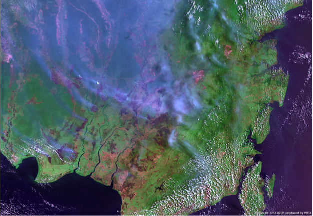
Satellite platforms can cover large field areas and measure crop yield in next-to-real-time, recording data every fifth of a second. The temporal re-visit time with most modern satellite platforms is between three and five days. Some satellite platforms, like Sentinel, can even penetrate cloud covers for 24/7 field monitoring. Satellite platforms use radar bands in both RGB and infrared sensors to capture shortwave spectral images of crop fields. The multi-spectral capabilities of today’s satellite platforms help measure CO2 and methane levels with high accuracy.
Still, even though modern satellite platforms can address multiple challenges with commercial agriculture, some limitations persist. For example, soil moisture is very difficult to measure from space because today’s imagers see fields as rather heterogeneous backgrounds. Besides, data from large satellite platforms, such as Landsat and Sentinel, is not always delivered in real-time, which complicates forecasting even further.
Modern Satellite Solutions For Accurate Yield Forecasting

One of the best solutions for measuring the winter wheat yield potential in commercial agriculture is to combine temporal-spatial satellite platform data with machine learning. The approach is already in use by private companies with constellations of small EO satellites, and it has proven more effective with yield forecasting. Machine learning and data analytics help uncover hidden links between soil and environmental conditions, resulting in better yield forecasting. One of the primary advantages of combining satellite platform data with ground-based machine learning analytics is the relative independence between input and output data because any missing variables can be assumed.
Some of the assumed variables may include weather data and national soil data, both of which are essential for yield forecasting. Obviously, assuming variables may lead to higher inaccuracy rates; however, commercialized agricultural monitoring can help solve all of these challenges, too.
Until recently, one of the biggest agricultural monitoring problems was farmers’ reliance on non-commercial EOS techs like LandSat and Sentinel. While the data from these platforms are available for free, the delay frame would often make any analytics unviable by the time the farmers could get hold of this information. However, with the advance in small satellites and CubeSats, it is now possible to offer more cost-effective solutions with lower delay frames. EOS companies deploying Earth Observing CubeSats can deliver information to their clients up to ten times quicker compared to Sentinel data.
Another advantage of using CubeSat platforms for agricultural forecasting is that imagers on these satellites can ensure high resolution, which means they can provide accurate information about smaller areas of land. While large satellite systems and platforms cover huge areas of land, smaller households simply cannot benefit from the data these platforms provide. Smaller constellations of CubeSats, however, effectively solve this problem, making sure their data can be of value to both large and small households.
Takeaway on Satellite Platforms for Commercial Agriculture
Satellite platform data is used in various commercial industries today, and ever more companies rely on data from space for fine-tuning their operations. Until recently, satellite platform data was available only to large farms and households, but the constant miniaturization of space technologies means that space tech is becoming ever more affordable. This, in turn, means that soon even smaller households should be able to rely on satellite platforms data for winter yield forecasting and measuring carbon dioxide levels. Important advances have already happened in this field, and more are likely to follow in the near future.
